
Description
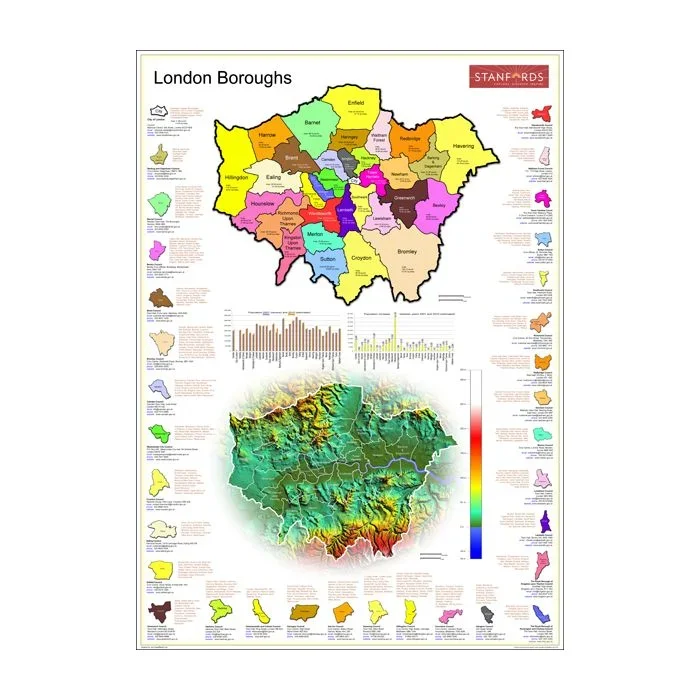
London in the Stanfords Maps of London Boroughs (PRINT ON DEMAND/FLAT MAPS) is designed and produced in-house by the digital department at our Long Acre store. The poster map shows both an administrative map of London Boroughs as well as a coloured relief map with borough boundaries overprinted.
The outer edges include population charts for 2001 (census) and 2010 (estimated) for individual boroughs; a population increase chart between 2001 and 2010 for individual boroughs; areas for individual boroughs (both in sq km and sq miles); council address, phone number, email and website for each borough; and shows main areas names for each borough
*PLEASE NOTE:*
– The map is available in A0 size.
– Borough maps are FLAT WALL MAPS and will be delivered rolled in a postal tube.
Reviews
There are no reviews yet.