
Description
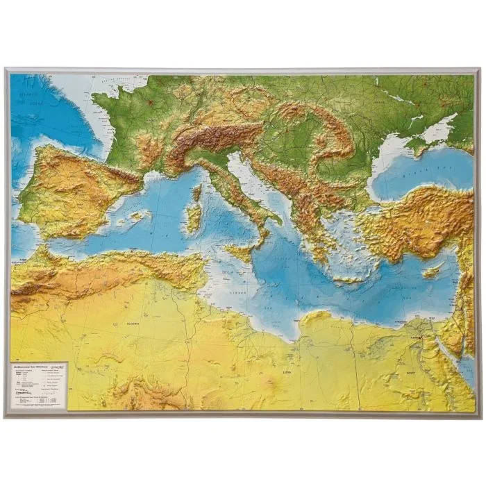
The Mediterranean Sea and the surrounding countries of Europe, Africa and the Middle East on a wall map, size 77 x 59.5cm (30.5″ x 23.5″ approx) – paper version, with National Geographic’s classic style of presentation: political boundaries outlined in contracting colours while the countries have light shading to indicate their physical geography. Within Europe coverage extends north well beyond what are usually considered Mediterranean countries, to include the English Channel, central Germany, Warsaw, all of Ukraine, and Volgograd. In Africa the map extends to the southernmost tips of Algeria and Libya. In the east part of the Caspian Sea, Georgia and Armenia, much of Iraq, and the Red Sea with Jeddah, Mecca and Port Sudan are included. Country names are in English; city names are in the language of their country (Warszawa, Wien, Tarabulus, Dimashq, etc) with the English equivalent in brackets. Selected main roads, railway connections and airports are marked. The map also shows oil fields and pipelines. On land masses light relief shading shows the topography; in the African countries plenty of names of mountain chains, deserts, etc are marked. Elevations on land and soundings in the Mediterranean, Black Sea and Red Sea are given in metres. Latitude and longitude lines are drawn at 5º intervals. PLEASE NOTE: this title is also available encapsulated.
![Rhineland-Palatinate · Saarland [10] Marco Polo Regional Map | 1:200,000](https://www.urbanfluxmart.com/wp-content/uploads/2025/12/rhineland-palatinate-saarland-10-marco-polo-regional-map-1-200-000-nflsllac87661.webp)
Reviews
There are no reviews yet.